Our Services
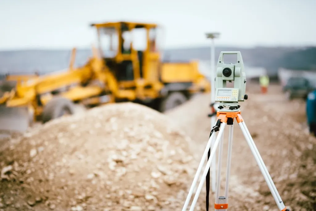
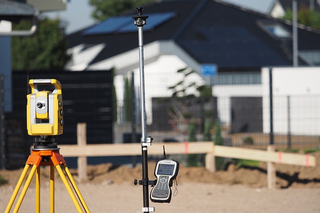
At Citymap Geosystems, we offer comprehensive land and engineering survey services designed to meet the diverse needs of our clients in construction, real estate, development, and infrastructure projects.
Our team of experienced surveyors uses state-of-the-art technology and proven methodologies to deliver accurate and reliable survey data, ensuring your project's success from inception to completion.
Land Survey
Land surveys are fundamental to understanding the precise boundaries and features of a property. Our land surveying services ensure accurate measurements and mappings, which are crucial for legal documentation, property transactions, and development planning.
Boundary and Property Surveys
- Define property lines and boundaries with high precision to avoid disputes and ensure legal compliance.
- Provide essential data for land division, property development, and real estate transactions.
Custom GIS Solutions
- Develop custom GIS applications and tools tailored to specific client requirements.
- Integrate GIS with other software systems to enhance functionality and data sharing.
Hydrological Modeling
- Develop hydrological models to simulate water flow, storage, and distribution in catchment areas.
- Aid in flood risk assessment, watershed management, and climate change impact studies.
Volume Calculations
- Calculate volumes of earthworks, stockpiles, and excavation sites for construction and mining projects.
- Provide accurate data for resource management and project planning.
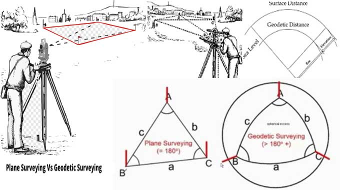
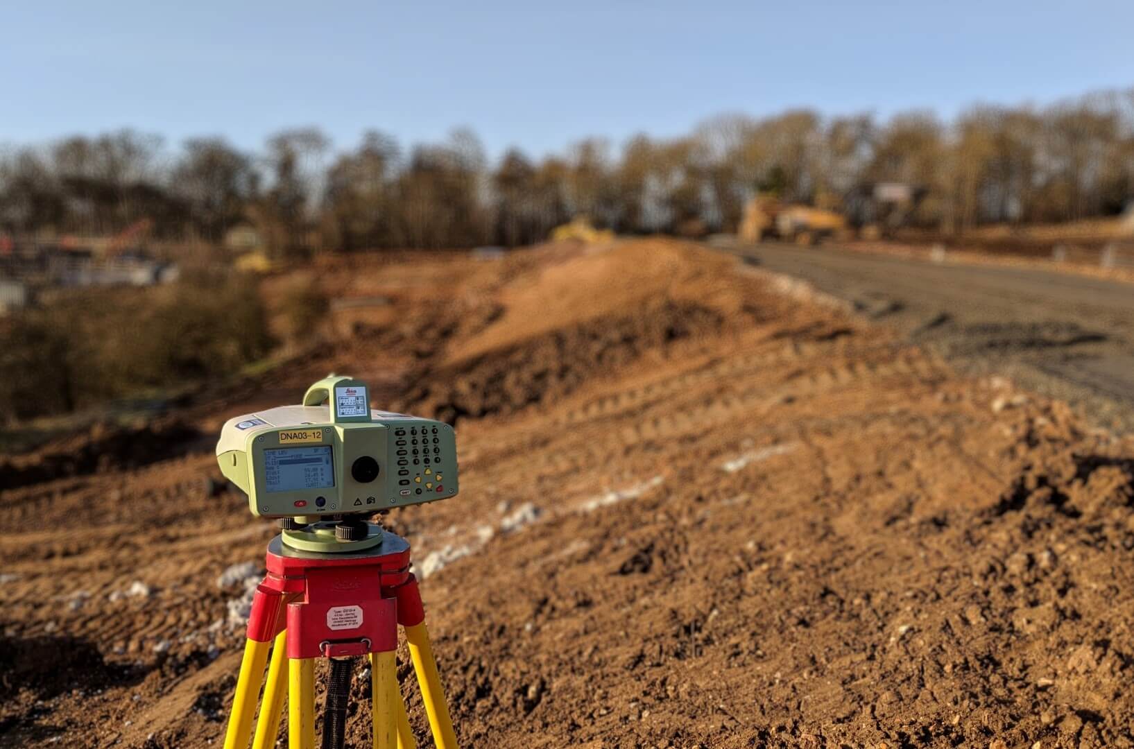
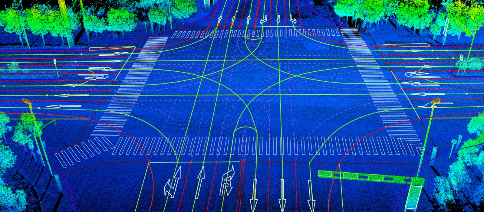
GPS Geodetic Surveys
Geodetic surveys involve measuring large areas of land using principles of geodesy, which considers the Earth's shape, gravity, and rotation. These surveys ensure precise location and positioning, critical for large-scale engineering projects.
Spatial Data Collection and Management
- Collect and manage spatial data from various sources, including field surveys, satellite imagery, and existing databases.
- Create and maintain geospatial databases that integrate diverse datasets for comprehensive analysis.
Mapping and Visualization
- Produce detailed maps that visualize spatial data, highlighting features such as land use, infrastructure, and environmental conditions.
- Develop interactive maps and web-based GIS applications for easy data access and visualization.
Spatial Analysis
- Perform spatial analysis to identify patterns, relationships, and trends within geographic data.
- Conduct proximity analysis, network analysis, and suitability modeling to support decision-making processes.
Custom GIS Solutions
- Develop custom GIS applications and tools tailored to specific client requirements.
- Integrate GIS with other software systems to enhance functionality and data sharing.
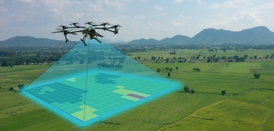
Drone Mapping
At Citymap Geosystems, we offer cutting-edge drone mapping services to provide high-resolution, accurate, and timely spatial data for a variety of applications. Leveraging the latest in unmanned aerial vehicle (UAV) technology, our drone mapping solutions are designed to meet the diverse needs of our clients across multiple industries.
Aerial Photography and Videography
- Capture high-resolution aerial images and videos for site inspections, marketing, and documentation.
- Provide visual assessments of large or inaccessible areas quickly and safely.
3D Modeling and Mapping
- Create detailed 3D models and maps of terrain, structures, and landscapes using photogrammetry techniques.
- Ideal for construction planning, architectural design, and volumetric calculations.
Topographic Mapping
- Produce precise topographic maps showing elevation contours, surface features, and landforms.
- Support engineering projects, infrastructure development, and environmental studies.
Infrastructure Inspection
- Conduct detailed inspections of infrastructure such as bridges, towers, power lines, and pipelines.
- Identify and assess structural conditions, maintenance needs, and potential hazards.
Hydrological Survey
At Citymap Geosystems, we specialize in providing comprehensive hydrological survey services designed to meet the needs of various industries, including environmental management, water resources planning, and infrastructure development. Our hydrological surveys provide critical data on water bodies, helping to inform decision-making processes and ensure sustainable water management practices.
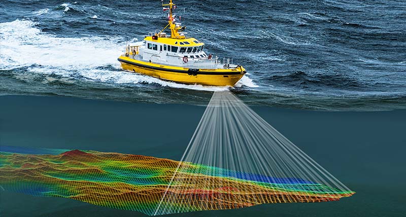
Bathymetric Surveys
- Measure the depth and topography of underwater surfaces in rivers, lakes, reservoirs, and coastal areas.
- Create detailed bathymetric maps to support navigation, dredging, and aquatic habitat studies.
Flow Measurement and Analysis
- Assess the flow rate and volume of water in rivers and streams using techniques such as current metering and acoustic Doppler profiling.
- Provide data for flood modeling, water resource management, and hydropower development.
Hydrological Modeling
- Develop hydrological models to simulate water flow, storage, and distribution in catchment areas.
- Aid in flood risk assessment, watershed management, and climate change impact studies.
Groundwater Surveys
- Assess groundwater levels, quality, and recharge rates using techniques such as borehole logging and aquifer testing.
- Provide data for groundwater resource management, well installation, and contamination studies.
LiDAR Mapping
At Citymap Geosystems, we offer advanced LiDAR (Light Detection and Ranging) mapping services that provide highly accurate and detailed 3D representations of the Earth's surface. Our LiDAR technology is ideal for a variety of applications, from topographic mapping and forestry management to infrastructure planning and disaster response.
Topographic Mapping
- Generate high-resolution topographic maps that accurately represent the elevation and contours of the land.
- Support engineering, construction, and environmental planning projects with precise elevation data.
Infrastructure Planning and Monitoring
- Create detailed 3D models of urban environments, transportation networks, and infrastructure.
- Aid in the design, construction, and maintenance of roads, bridges, and buildings.
Mining and Quarrying
- Conduct volumetric analysis of stockpiles, excavation sites, and mine surfaces.
- Support resource management, operational planning, and environmental compliance.
Flood Risk Assessment and Management
- Map floodplains and assess flood risk areas using high-resolution elevation data.
- Support flood mitigation planning, emergency response, and climate change adaptation strategies.
Topographical Surveying
At Citymap Geosystems, we provide comprehensive topographical surveying services that deliver precise and detailed information about the natural and man-made features of a site. Our topographical surveys are essential for various applications, including construction planning, land development, environmental studies, and infrastructure projects.
Site Surveying
- Conduct detailed site surveys to capture the existing conditions of the land.
- Identify and map natural features such as hills, valleys, rivers, and trees, as well as man-made structures like buildings, roads, and utilities.
Contour Mapping
- Create contour maps that represent the elevation and slopes of the land surface.
- Assist in understanding the topography for drainage design, flood risk assessment, and construction planning.
Boundary and Property Surveys
- Define property lines and boundaries with high precision to avoid disputes and ensure legal compliance.
- Provide essential data for land division, property development, and real estate transactions.
Volume Calculations
- Calculate volumes of earthworks, stockpiles, and excavation sites for construction and mining projects.
- Provide accurate data for resource management and project planning.
GIS and Remote Sensing
At Citymap Geosystems, we offer advanced Geographic Information Systems (GIS) and Remote Sensing services to provide comprehensive spatial data analysis and mapping solutions. These services support a wide range of applications, from urban planning and environmental monitoring to infrastructure development and disaster management.
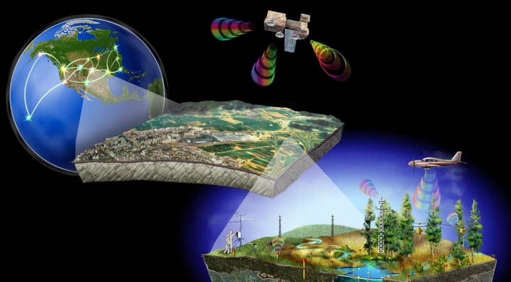
Spatial Data Collection and Management
- Collect and manage spatial data from various sources, including field surveys, satellite imagery, and existing databases.
- Create and maintain geospatial databases that integrate diverse datasets for comprehensive analysis.
Mapping and Visualization
Produce detailed maps that visualize spatial data, highlighting features such as land use, infrastructure, and environmental conditions.
Develop interactive maps and web-based GIS applications for easy data access and visualization.
Geocoding and Address Mapping
- Convert addresses into geographic coordinates to visualize and analyze location-based data.
- Create accurate address maps for urban planning, service delivery, and emergency response.
Spatial Analysis
- Perform spatial analysis to identify patterns, relationships, and trends within geographic data.
- Conduct proximity analysis, network analysis, and suitability modeling to support decision-making processes.
Sectional Property Surveys
Sectional Property Surveys are a specialized type of property survey typically conducted in the context of sectional title properties. Sectional title refers to properties that are divided into sections and common property, such as apartments, townhouses, or office buildings, where different units are owned individually while common areas are owned collectively.
Boundary and Title Surveys
- Boundary Determination: Ensures that the boundaries of each section (individual unit) and common areas are accurately defined and marked.
- Title Verification: Confirms that the title deeds and property descriptions match the physical layout and boundaries of the property.
Floor Plan and Area Calculation
- As-Built Plans: Creation of detailed floor plans showing the layout of each unit and common area.
- Area Measurement: Accurate measurement of the floor area of each unit, which is critical for determining ownership shares and levies.
Sectional Title Plans
- Drafting Sectional Plans: Preparation of detailed sectional plans as required by local authorities for registration purposes.
- Subdivision Plans: Creating plans that subdivide a building into multiple sections (units) and common areas according to the sectional title scheme.
Compliance and Certification
- Regulatory Compliance: Ensuring that all aspects of the survey comply with local laws and regulations.
- Certification: Providing necessary certifications and documentation for the registration of the sectional title scheme.